Reading the Land: What an Aerial Field View Tells a Farmer
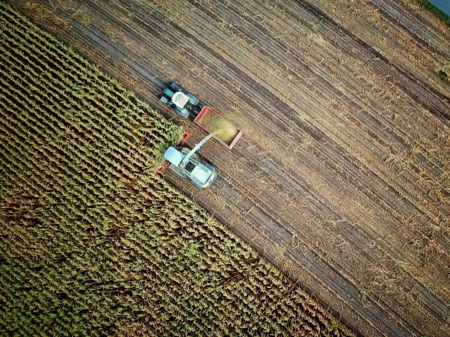
Stand at the edge of a 20-acre field and you see the edge. Stand 150 metres above it and you see the whole — and the whole tells a very different story from the parts. Aerial field imaging is rapidly becoming one of the most accessible and impactful tools available to farm managers, offering a perspective that fundamentally changes how land is understood and managed.
What You Can See from Above That You Cannot See from the Ground
Human vision from ground level is excellent at detail but poor at pattern. From the air, patterns emerge that are simply invisible at field level:
- Growth variability: Patches of stunted or advanced growth across a field — often caused by soil type variation, historical compaction zones, or past drainage problems — stand out clearly in aerial imagery.
- Waterlogging: After heavy rain, aerial images taken within 24–48 hours show exactly where water has pooled, helping guide drainage improvement work.
- Irrigation coverage: Gaps in drip or sprinkler coverage become visible as drier, paler strips or patches — identifying which emitters need attention before crop stress sets in.
- Pest and disease spread: Many crop diseases and pest infestations create visible damage patterns that propagate in directions related to prevailing wind, water flow, or field entry points. Aerial imagery captures these patterns early.
Multispectral Imaging: Seeing Beyond Visible Light
The most powerful aerial crop monitoring uses multispectral cameras that capture light beyond the visible spectrum — particularly near-infrared (NIR). Plants that are photosynthesising actively reflect NIR strongly; stressed plants reflect less. The NDVI (Normalised Difference Vegetation Index) derived from NIR and red band imagery creates a quantitative map of crop vigour that is far more sensitive than anything the human eye can detect.
This technology, once available only to large agribusinesses with specialist equipment, is now accessible through commercial drone services and satellite imagery subscription platforms at costs that are feasible even for medium-scale farms.
Translating Images into Farm Actions
An aerial image is only valuable if it drives a decision. The workflow at Kreevann moves from image to insight to action:
- Images are captured at key crop growth stages
- Variability zones are identified and mapped against soil test data and historical yield records
- Variable-rate application maps are generated — specifying different input rates for different zones within the same field
- Applications are made with GPS-guided equipment to match the prescription map
- Outcomes are measured at harvest to validate and refine the model for the next season
The Economics of Aerial Farm Intelligence
The business case for aerial monitoring becomes clear when you calculate the cost of not using it. A single undetected irrigation blockage running for a week can reduce yield across a significant field area. A disease outbreak that spreads unchecked for two weeks because it was not spotted on the ground can devastate a crop. Against these risks, the cost of periodic aerial surveys is modest.
More fundamentally, understanding your land better is what precision agriculture is about: using resources where they are needed, and not using them where they are not. That principle — doing more with less — is both economically and environmentally the right direction for Indian farming.
Explore More Insights
Browse all our articles on smart farming, agri-tech, and sustainable agriculture.
Back to Blog